
Digging into 14,000 years of A66 archaeology
Date Written
29 September 2026
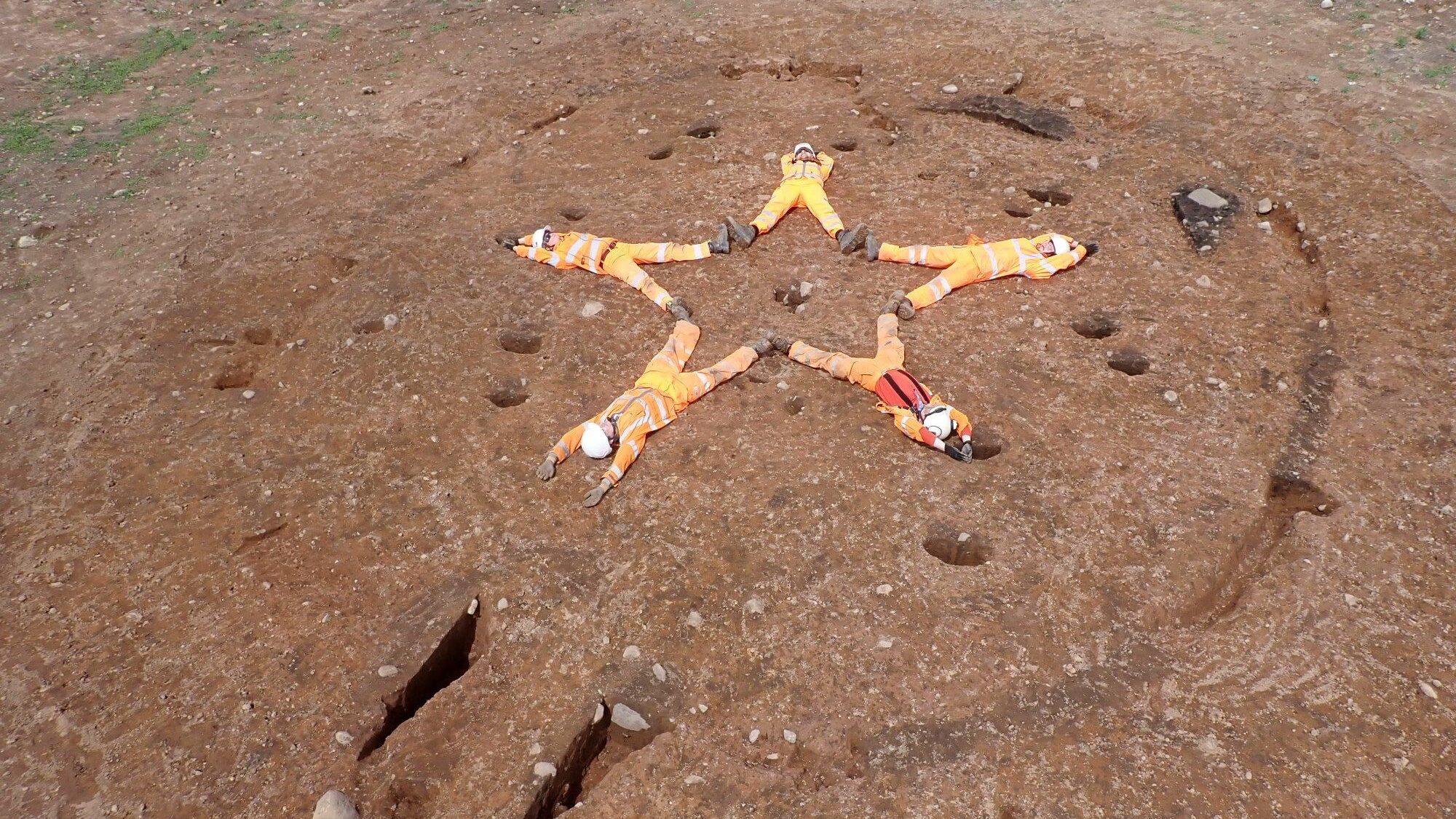
With over 75 archaeologists, more than 66 hectares excavated, and 548 days of excavation and counting, archaeology on the A66 has uncovered a landscape shaped by thousands of years of travel, trade and people living their everyday lives in the Eden Valley.
Over the course of the project, Oxford Cotswold Archaeology have uncovered evidence of prehistoric communities stretching back more than 12,000 years, Roman soldiers and civilians, rare evidence of domestic life during Cumbria’s post-Roman ‘Dark Ages’, and later Medieval farming landscapes.
From Penrith to Brough, these are some of the standout discoveries from the A66 project, and the stories they tell about the people who once lived, worked and travelled through this landscape.
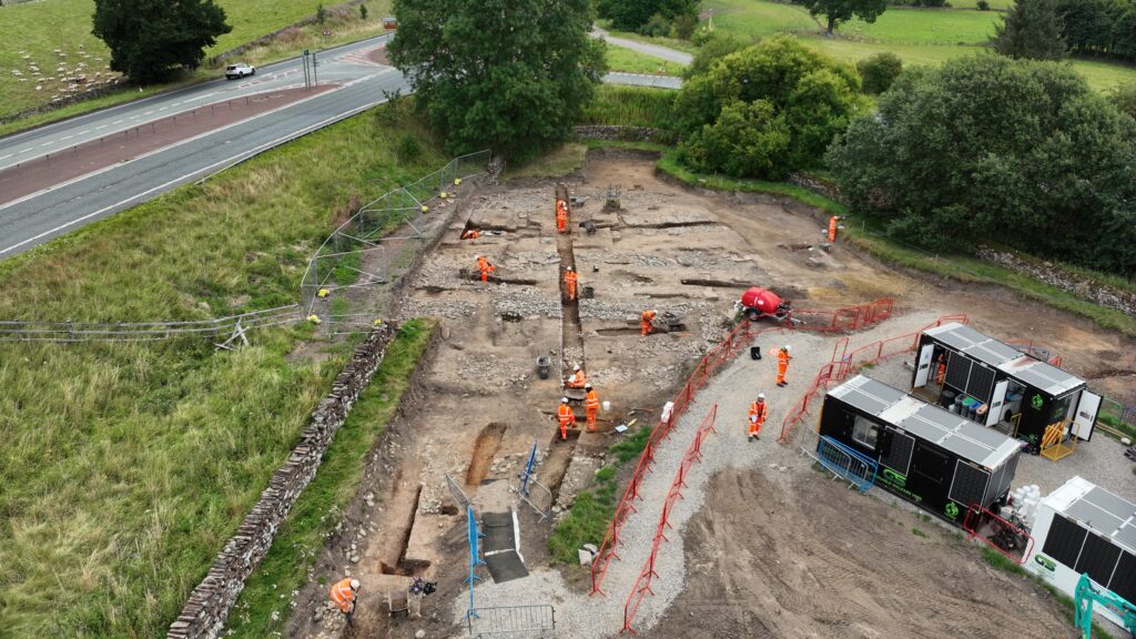
Image: overhead shot of archaeologists working on Roman vicus settlement
Why are we undertaking work?
The A66 has been an important route through the landscape for thousands of years, connecting communities, people and places across the Pennines. Today is no exception, with the route carrying large volumes of traffic between Cumbria and County Durham.
The A66 Northern Trans-Pennine project, led by National Highways, aims to improve the route and help ease congestion by dualling the remaining single carriageway sections of the route between Penrith and Scotch Corner. As part of the upgrade, Oxford Cotswold Archaeology is working alongside the wider project team to investigate and record the archaeology uncovered along the route, helping to reveal the stories of the people who travelled, lived and worked here in the past.
The project has brought together teams from Oxford Cotswold Archaeology, AtkinsRéalis, Balfour Beatty, Kier and Aureos.
Understanding the Roman landscape outside Penrith
At the westernmost point of our excavations along the route, outside the town of Penrith, our archaeological work focused primarily on the landscape surrounding the scheduled Roman fort of Brocavum. This included work on both a Roman vicus, or civilian settlement, and a known cremation cemetery.
This high concentration of Roman archaeology has produced some of the project’s most remarkable discoveries.
Archaeologists spent months meticulously excavating hundreds of cremation burials within the cemetery, revealing complex details about how people buried and remembered their dead.
The site offered substantial evidence of funerary activity. This included the remains of a funeral pyre on which members of the military and civilian population had been cremated, burials containing remains placed in beautifully decorated urns or boxes, stone-lined cist burials, and pits containing the ashes and charcoal collected from the remains of pyre cremations.
The stone-lined cists burials would have been covered with stone slabs. Our work discovered one inscribed with writing and decoration.
Many burials were furnished with objects that accompanied the cremation urns, including vessels made from glass and pottery, figurines, jewellery, and even elements of military equipment and weapons.
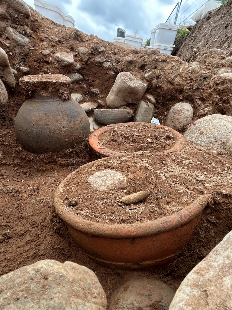
Image (right): Roman cremation burial with three vessels, including two Samian ware accessory bowls.
The cemetery featured on the BBC’s Digging for Britain in January 2026, bringing these discoveries, and the meticulous work involved in excavating hundreds of burials, to a wider audience.
The Roman discoveries around Brocavum don’t stop at the cemetery.
Archaeologists also uncovered evidence of a Roman vicus, a civilian settlement that developed around Brocavum fort (see above image). Extensive excavations have uncovered timber and stone buildings separated by trackways, wells, rubbish pits and ovens.
One of the more common finds from both the cemetery and vicus is Samian ware, a distinctive type of fine Roman pottery known for its red, glossy surface and often elaborate decoration. Much of this pottery was produced in workshops in Gaul (modern-day France) and along the Rhineland before being traded and exchanged across the Roman Empire, eventually making its way to Cumbria. Large quantities were recovered during the excavations, including some exceptionally well-preserved examples.
By studying where this pottery was made and how it travelled, archaeologists can begin to trace the trade networks that connected communities in Cumbria with places much further afield.
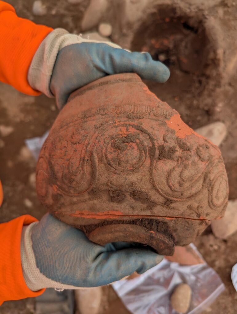
Image (right): fragment of decorated Samian ware.
Across the road from the Roman vicus, archaeologists uncovered a wicker-lined well containing five preserved Roman shoes. Their survival is thanks to the waterlogged conditions within the well, which has helped preserve the leather.
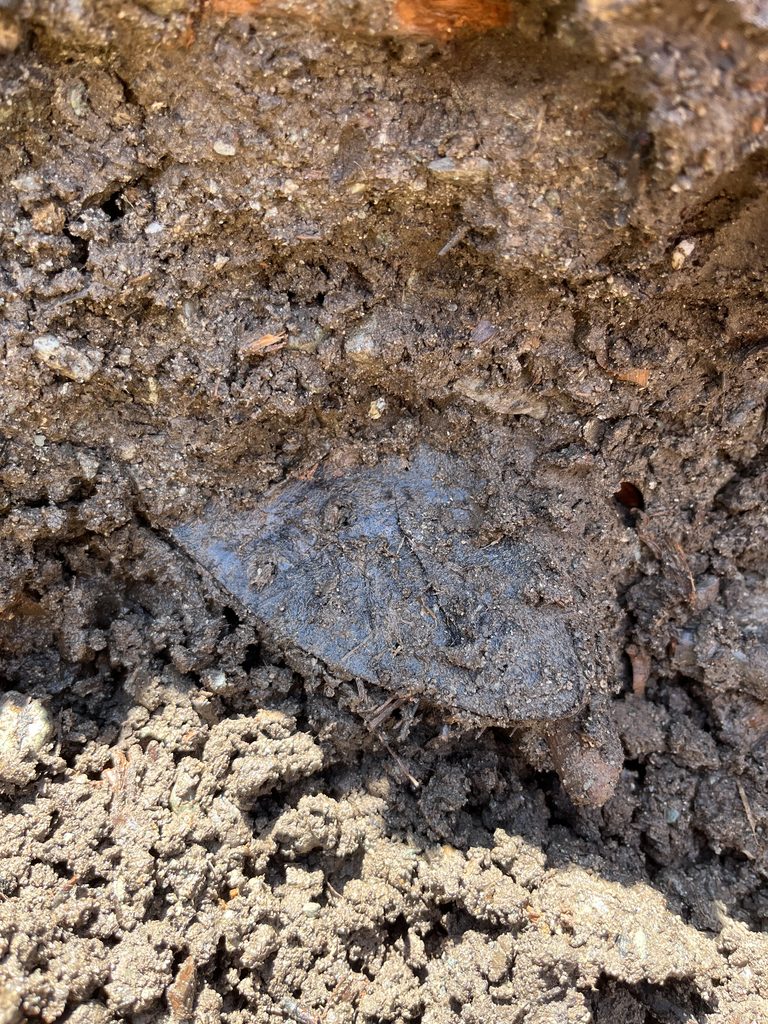
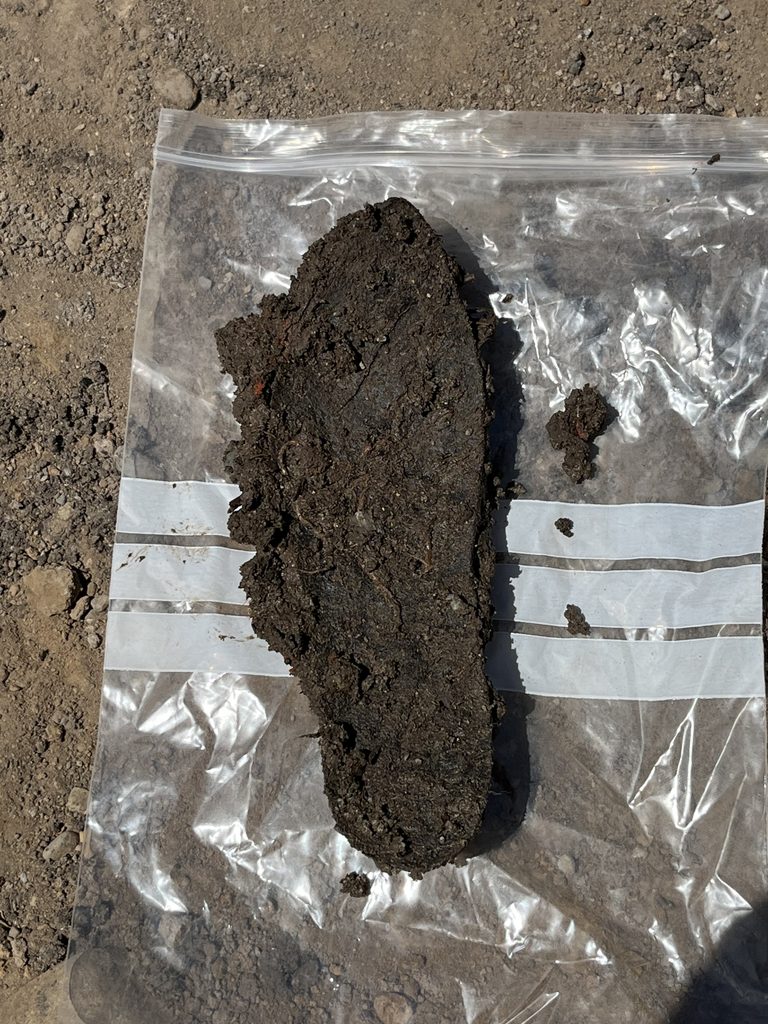
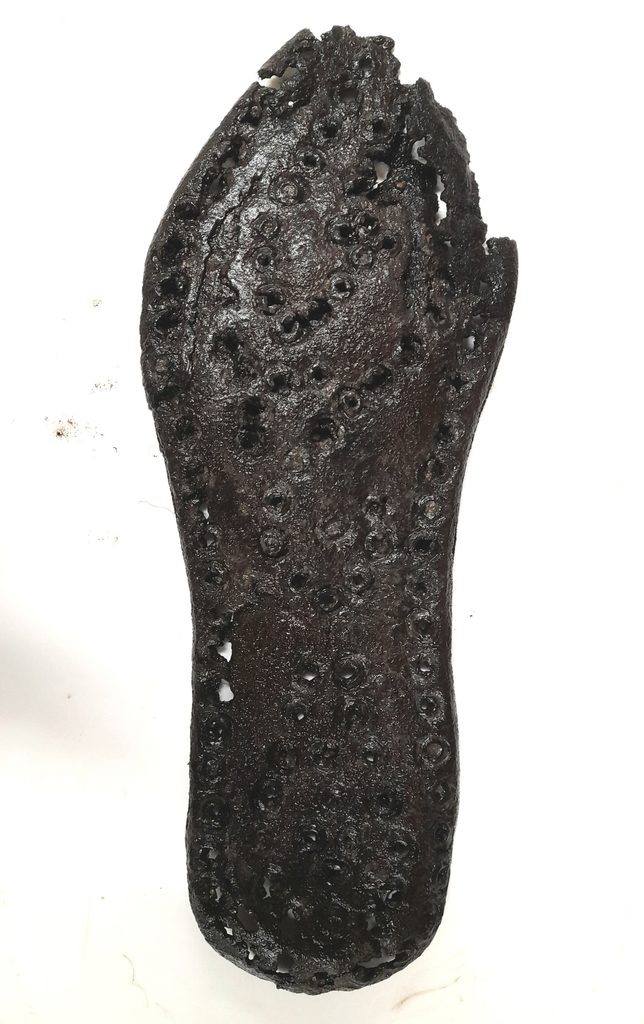
Images: Roman shoe sole, during excavation, directly after lifting, and once cleaned
Overall, the Roman discoveries around Brocavum fort offer archaeologists a unique opportunity to explore different aspects of Roman society, from everyday life to death and burial, all within the same landscape. Together, they reveal just how diverse the Roman Empire was, encompassing different people, places, beliefs and traditions. The archaeology along the A66 reflects this complexity, creating a fascinating and sometimes puzzling picture of how these different influences came together in one place.
Life after Rome: Cumbria’s post-Roman ‘Dark Ages’
Further along the A66 around Kirkby Thore, our discoveries move into one of the least understood periods of Cumbria’s past: the post-Roman, Early Medieval period.
The end of Roman Britain did not mean that people simply disappeared from the landscape. Communities continued to live, work and farm here. This is seen at Kirkby Thore, a settlement arranged along an earlier Roman road. However, we know surprisingly little about what everyday life was like for these communities.
The A66 project is helping to fill this gap.
Archaeologists uncovered evidence of a domestic settlement, including a large timber hall measuring approximately 10 metres long and 5 metres wide (seen below). Several sunken-featured buildings (SFBs), usually understood as workshops or outbuildings, were also identified. More recently a threshing floor — a stone surface where grain may have been processed — was excavated.
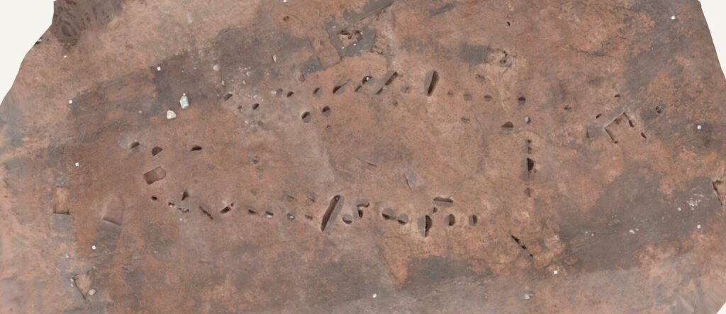
Image: overhead shot of Early Medieval timber hall
A burnt grain-filled pit offers additional glimpses into everyday life within the settlement. It contained barley and oats, as well as fragments of roundwood basketry, potentially from a storage basket. Together, these features provide a rare insight into domestic life during this period. Although finds are relatively sparse, discoveries such as spindle whorls within the SFBs provide evidence of textile production.
For a period of history that we still know relatively little about, these discoveries give us a valuable glimpse into how people during the so-called ‘Dark Ages’ of Cumbrian history.
Prehistory on the A66
Moving further east, between Appleby and Brough, the archaeology takes us deep into Cumbria’s prehistoric past — from the Late Upper Palaeolithic through to the Bronze Age.
The A66 project has uncovered a wealth of archaeological evidence from this vast stretch of prehistory, from thousands of carefully worked flints to prehistoric settlements, burial sites and some exceptionally rare finds.
Some of the earliest evidence comes not from individual artefacts, but from the landscape itself.
Specialist geoarchaeologists have been investigating the prehistoric environment around Sandford Mire, examining soils, layers of sediments and other environmental evidence.
The modern-day Sandford Mire represents the remains of Lake Ormside, a prehistoric water basin that formed directly after the last Ice Age as ice melted and flooded the landscape. The lake would have created a rich natural environment, providing water and attracting wildlife, making it an important hunting resource for prehistoric communities. Over time, the lake gradually silted up, and the water basin filled, creating the landscape we see at Sandford Mire today.
Evidence of human activity around the former lake shores stretches back around 14,000 years. Among our finds are Late Upper Palaeolithic long blades, dating to this period and providing some of the earliest evidence for people using this landscape.
Lake Ormside is a key factor in what makes the prehistoric archaeology along its former shores so significant. Understanding its influences and how the landscape changed will ultimately help us understand how people may have used it.
Image (right): Archaeologists recording environmental samples
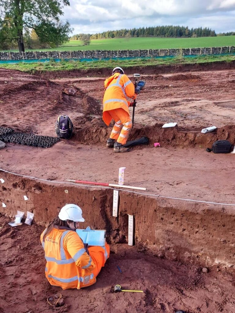
There have been numerous flint scatter excavations, with archaeologists carefully recording thousands of pieces of worked flint preserved on old ground surfaces. These excavations have provided some beautiful examples of prehistoric toolmaking, revealing the skill and craftmanship involved in carefully shaping stone into tools.
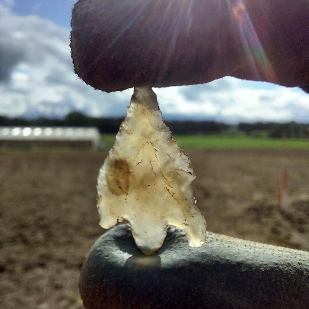
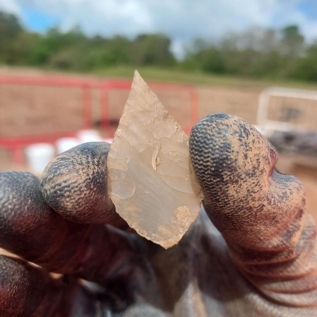
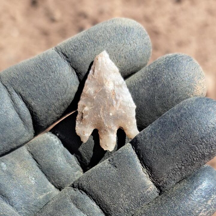
Images: examples of flint tools from across the A66 scheme. (left): Bronze Age arrowhead. (middle): Early Neolithic leaf-shaped arrowhead. (right): Bronze Age arrowhead
But flint wasn’t the only stone attracting prehistoric attention along the A66.
The Cumbrian Lake District is well known as a source of distinctive green stone called ‘tuff’. This was quarried in the mountains during the early neolithic specifically to produce polished stone axes, which would have been traded along the natural pass now used by the modern A66. Work on the A66 has uncovered numerous examples within this area, adding to our understanding of the Neolithic axe trade.
Archaeologists have also uncovered an extraordinary abundance of worked rock crystal and quartz.
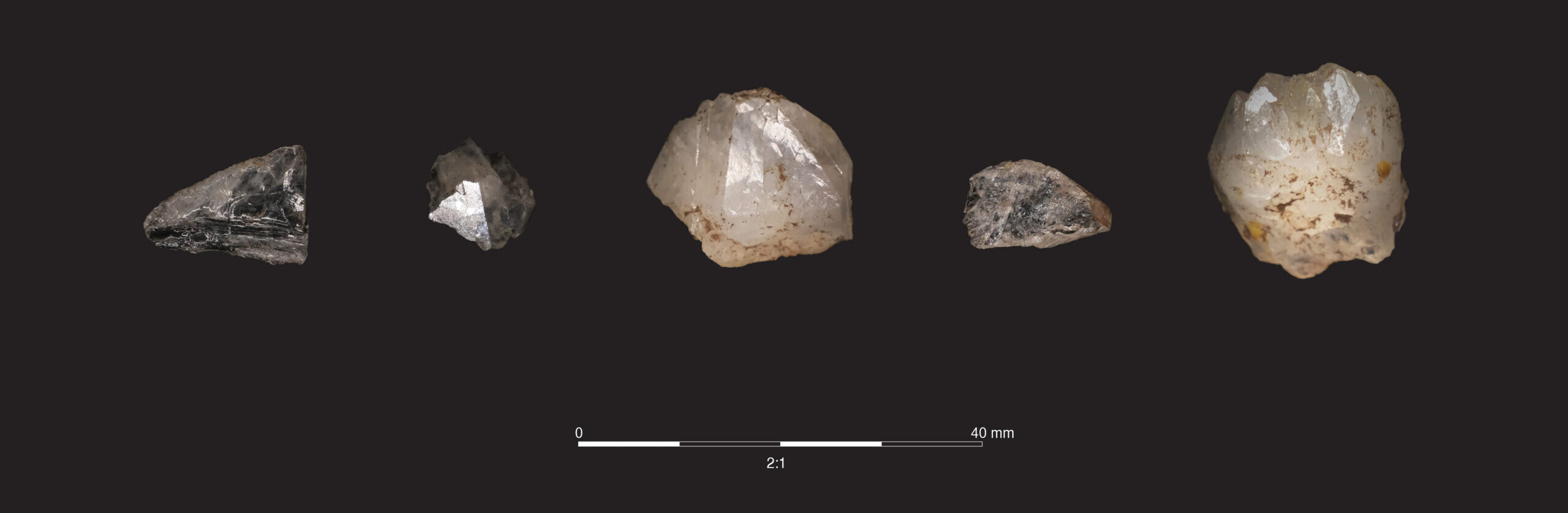
Image: collection of rock crystals from A66 assemblage
Evidence for people gathering, keeping and working rock crystal is phenomenally rare. Across the UK, around 40 archaeological sites are known to show evidence of this activity.
The A66 project has produced the largest assemblage of worked rock crystal yet identified in the UK, all associated with Early Neolithic activity.
The discovery provides a fascinating insight into prehistoric people’s relationships with the natural materials around them. Rock crystal is visually distinctive and far less commonly encountered in archaeological assemblages than flint or tuff.
The sheer scale of the A66 assemblage makes this one of the project’s most remarkable prehistoric discoveries, raising new questions about why prehistoric communities collected and worked this unusual material.
Excavations in several areas between Kirkby Thore and Brough have uncovered evidence for Bronze Age buildings and burial activity.
Evidence for this included a large communal hearth, pits containing daily rubbish, and evidence of fence lines, providing a glimpse into the communities who lived and farmed the landscape along the A66 thousands of years ago.
The Sandford Barrows, a long-known group of Bronze Age burial monuments first recorded in the 18th century, were excavated with the help of local volunteers. These monuments show us how communities buried their dead, while the settlement evidence offers clues about the lives of the people who built and used monuments like them.
Bronze Age cremation burials have been found in several locations along the A66 excavation route, adding to the picture of how prehistoric communities used this landscape.
One particularly interesting concentration was found downslope from Sandford Barrows, where 19 cremation burials were contained within a ring gully.
Image (top): overhead photo of Bronze Age building
Image (bottom): archaeologists excavating cremations at ring gully
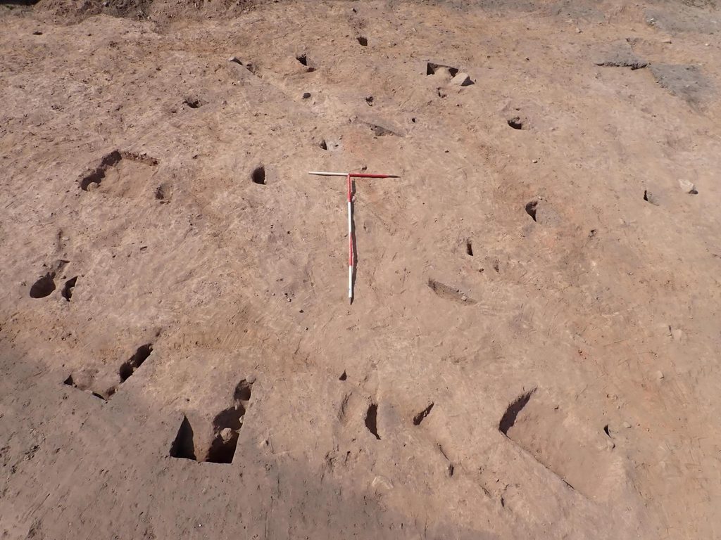
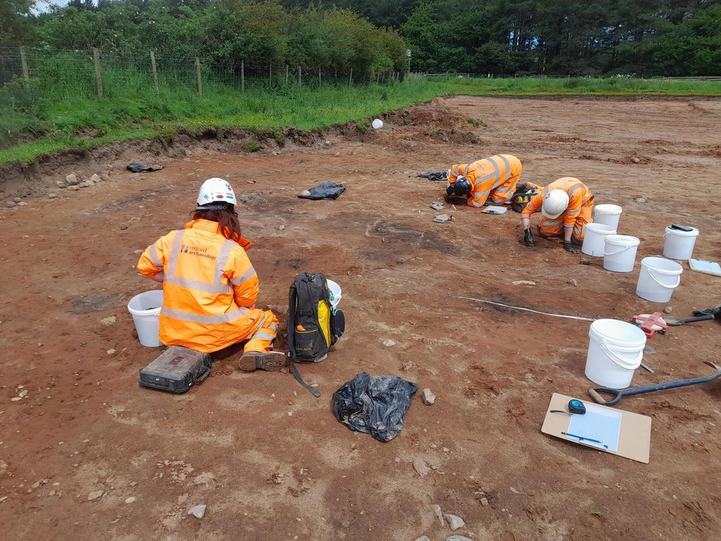
Among these was the cremation of an infant or young child, accompanied by a beautifully decorated Bronze Age cup (images below), deliberately placed alongside their remains. Another cremation contained a bronze blade, providing further evidence of the objects placed with the dead.
Another key concentration of prehistoric activity was found at Kirkby Thore, where archaeologists uncovered five collared urn cremations (two deposited upside down) alongside several unurned cremations, close to evidence of occupation and buildings.
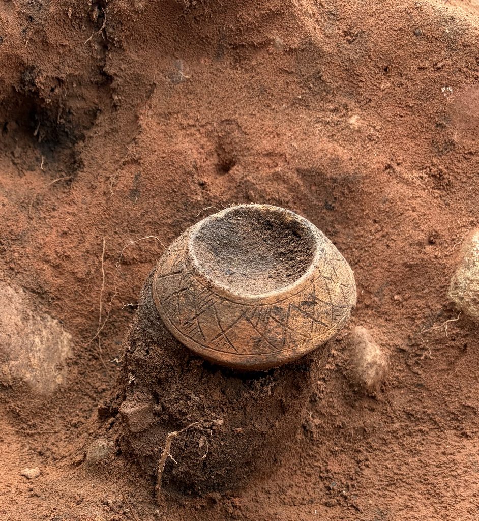
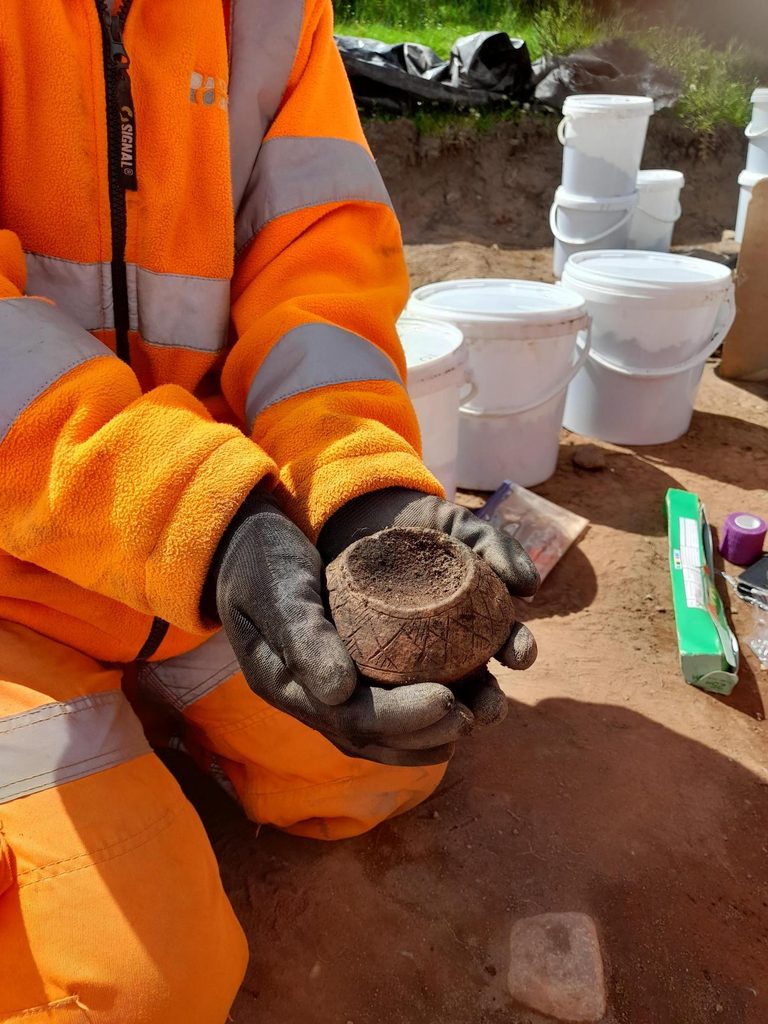
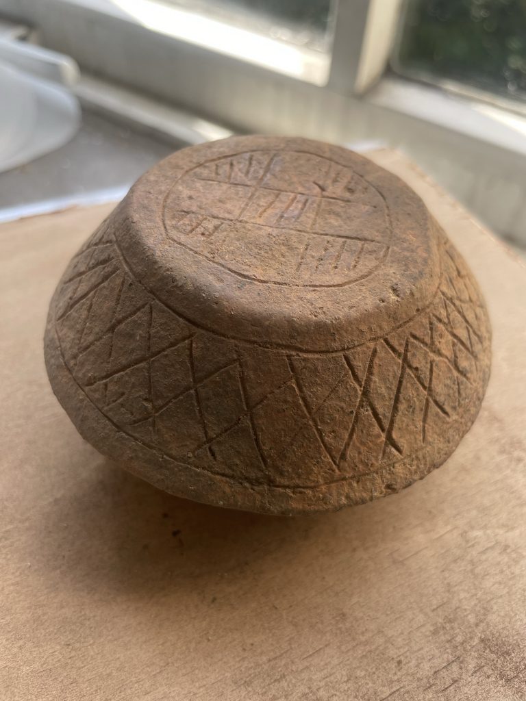
Images: decorated Bronze Age accessory cup
Together, these discoveries are helping to build a much fuller picture of Bronze Age life along the A66 — from the settlements where people lived, to the monuments and burial places where they remembered and commemorated the dead.
The scale of what has been uncovered along the A66 is remarkable. Across more than 66 hectares and hundreds of days of excavation, archaeologists have uncovered evidence spanning thousands of years.
Over 10,000 archaeological features, 23,580 finds and 6000 samples taken so far.
And yet, for all that we have discovered, the excavation has not given us all the answers. In many cases, it has done the opposite. It has opened even more questions about who these people were, how they lived, and why they used this landscape in the ways they did.
The finds, environmental remains and burial evidence will now continue to be studied in greater detail through post-excavation analysis, specialist research and scientific dating.
So, while the digging may be coming to an end, the archaeology of the A66 is far from finished. There is still much more to discover and, perhaps most excitingly, we don’t yet know exactly what those discoveries will reveal.
Want to see for yourself?
Our Free pop-up museum will be traveling along the A66 route. For more details click here.