
The wonderful world of Sizewell
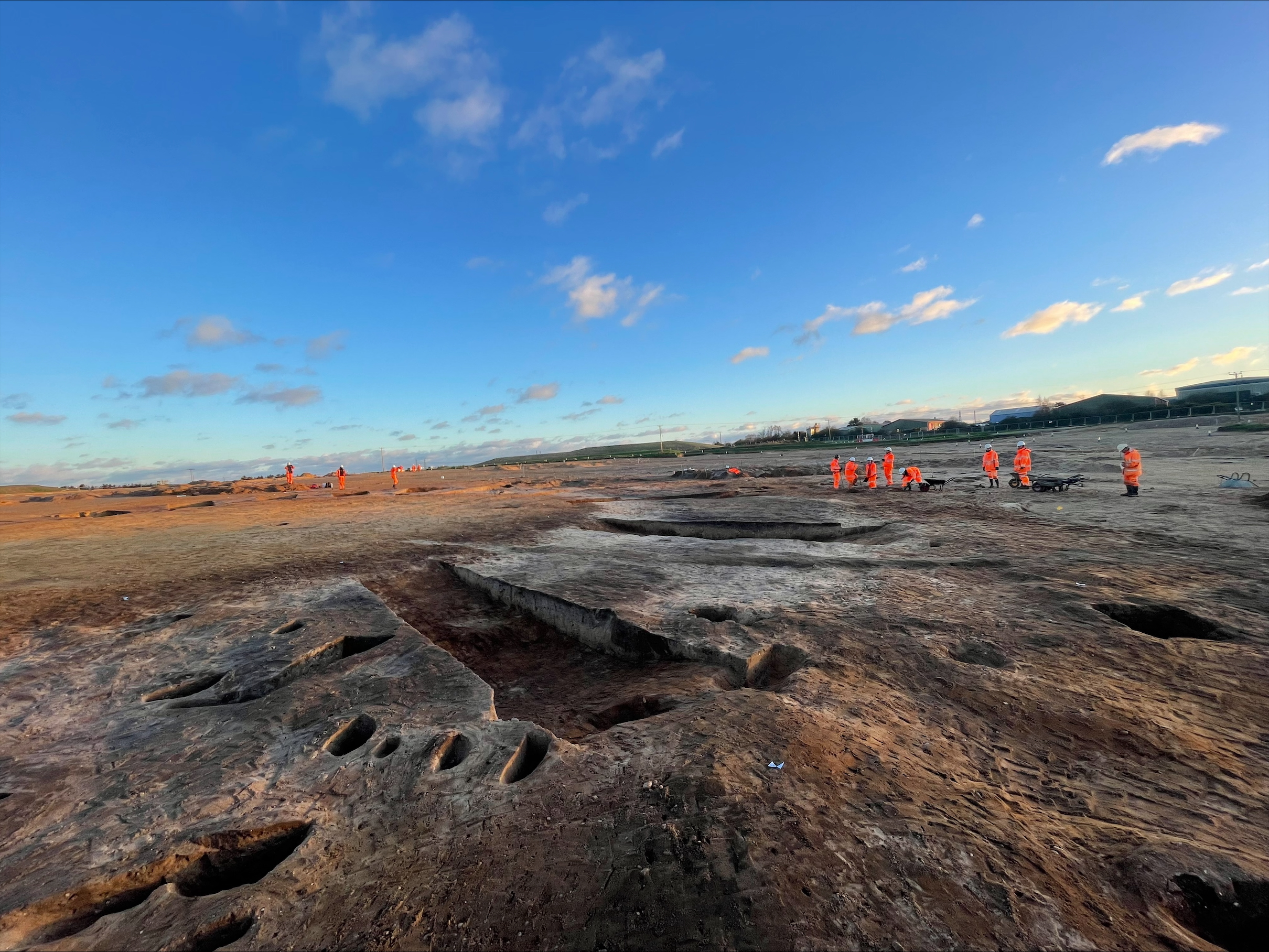
Time for a spring update on the wonderful world of Sizewell; a quick run through of what’s new, what’s changed and what’s currently playing on our minds in post-ex (the process after fieldwork of understanding everything we’ve found) for the Sizewell C nuclear power station project. I’ll go through by period, try to be brief (which for me will be a personal accomplishment) and not play to my prejudices.
This update will take a landscape view of the excavations, so take a moment to familiarise yourself with the sites and their geology before we dive in.

The Neolithic
To get the ‘bad’ news over with first, pottery recovered from the posthole buildings excavated in the densest area of Early Neolithic pitting at Green Rail Route has confirmed a Late Bronze Age date. While it is a shame not to have Neolithic buildings, roundhouses and four-posters fit the Late Bronze Age pattern, so it keeps my worldview intact, which is a relief.
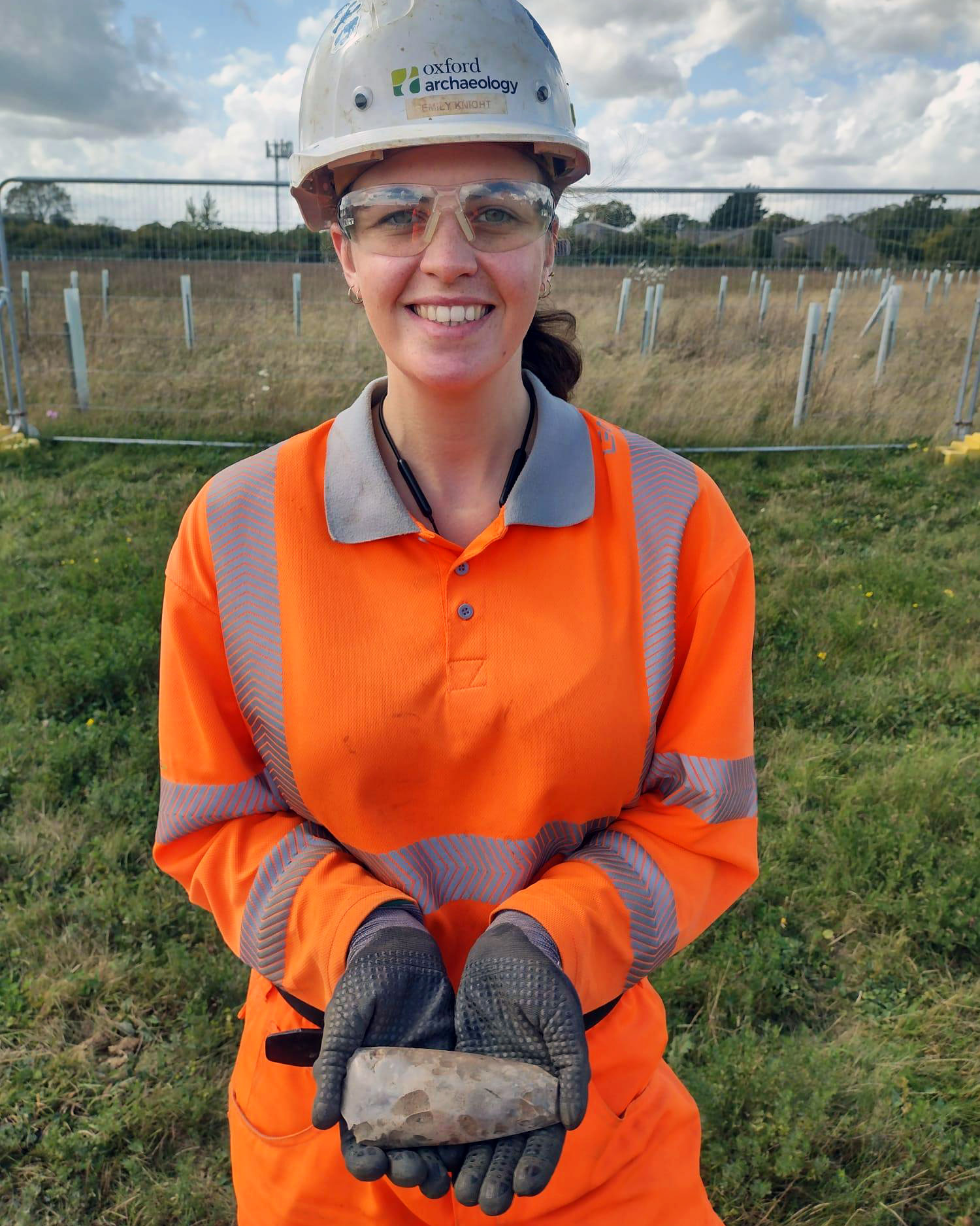
It is still by far the biggest and therefore best Neolithic site we have, with hundreds of pits, containing 3,000 sherds of pottery and over 10,000 struck flints, including five polished axes and a quern stone! We can already see differences between the finds assemblages at this site and the second largest Early Neolithic site at North of Lovers Lane, 700m to the east. This bodes well for future inter-site analysis in the eternal search for who did what, where, when, and why.
Image: Emily with one of the five polished axes found on Green Rails
A site at Sizewell Link Road, Middleton has revealed another couple of the large Early Neolithic storage pits, but they’re down in the base of the valley and were flooded most of this past winter. This could raise a red flag – why would you put storage pits in a flood zone? However, it speaks to the changes that have taken place in the water table over the past 6000 years – what are now wetland, coastal valleys were then sitting in a high, well-drained ‘upland’.
The Bronze Age
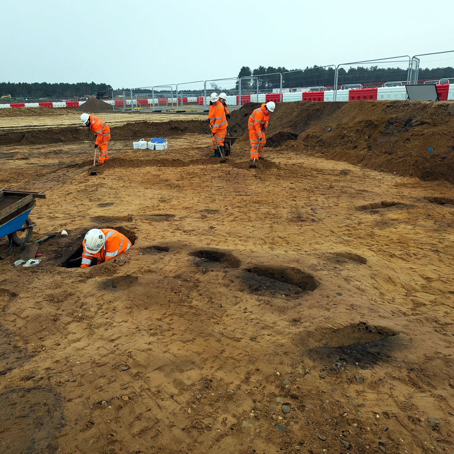
Beaker pit groups keep on coming, and with a couple more recently at Goose Hill and those on the Sizewell Link Road (Middleton and Theberton), we’re up to thirty-two pit groups now, with each group containing between 5 and 15 pits each. The pit groups themselves come in clusters, so we have clusters of groups, each separated by a kilometre or so; these larger clusters all sit on slightly higher, dryer ground adjacent to shallow, damper valleys, which begs the question – if this is another pattern, what does it mean?
Image: Beaker pit group mid-excavation on Goose Hill
A recent reappraisal of the flint and pottery at Stonewalk has led to the identification of the earliest roundhouse on the project, an Early Bronze Age posthole structure that sits in a scatter of contemporary pits and finds. The postholes contain lots of burnt worked flints, and burnt and fired clay. Early Bronze Age roundhouses are rare as hen’s teeth; one of the only other comparable examples we can think of, at Bradley Fen near Peterborough, also had postholes stuffed with burnt worked flint, burnt pottery, and fired clay. Once again, are we looking at pattern or coincidence?

The Iron Age
There have been no huge changes in the Early Iron Age discoveries of late; the activity still clings like a limpet to the edge of the boulder clay as it peters out over the sands and gravels, sat there to get the best out of both these soil types and the blend of the two as they merge.
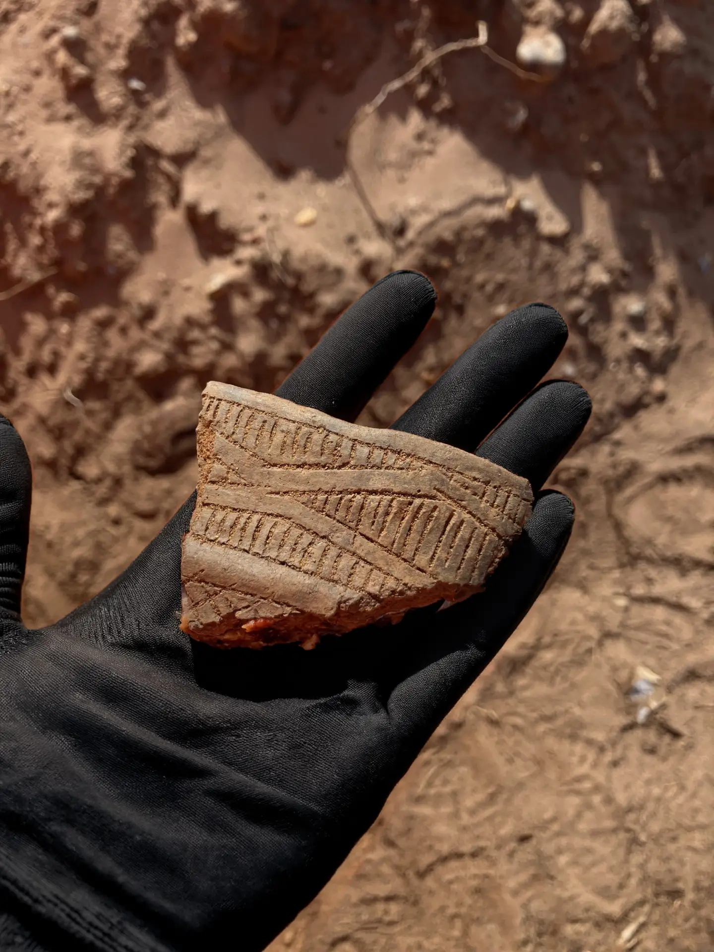
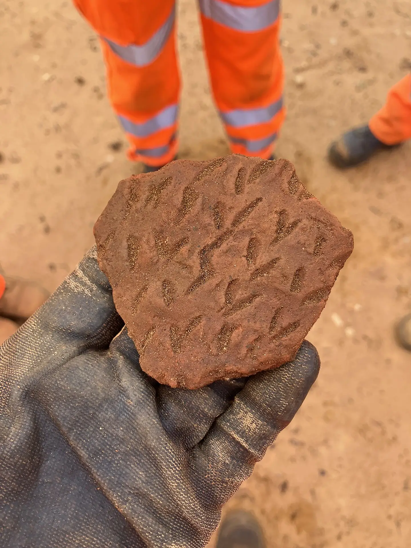
We are looking at one of the largest assemblages of Early Iron Age pottery in the county, with activity beginning in the Late Bronze Age in the west at Green Rails Route, spreading across the project area through the Early Iron Age and petering out in the east at Goose Hill in the earlier part of the Middle Iron Age.
Image: a sherd of Early Iron Age pottery recovered on site

This assemblage may cover as much as six hundred years from c.900–300 BC. If so, this would make this occupation the exception in prehistory at Sizewell, as the visible Neolithic and Beaker activity each lasts no longer than three hundred years. Middle Iron Age activity also spreads eastwards onto the sands of Goose Hill, somewhere the Early Iron Age feared to tread.
The Roman
The Romans at Sizewell continue to interest and excite (not something you hear every day), because it is different to the norm – it doesn’t fit the pattern – none of it is your ‘run-of-the-mill Romano-British farmstead’. The focus here was on the coast, which by the 2nd/3rd century had crept up to the edges of Goose Hill and Wetland Recreation, and on what the coast provided — salt. We have three salt-working locations (salterns) so far, and a part of what may be a a fourth, but this might also represent some other ‘coastal’ activity.
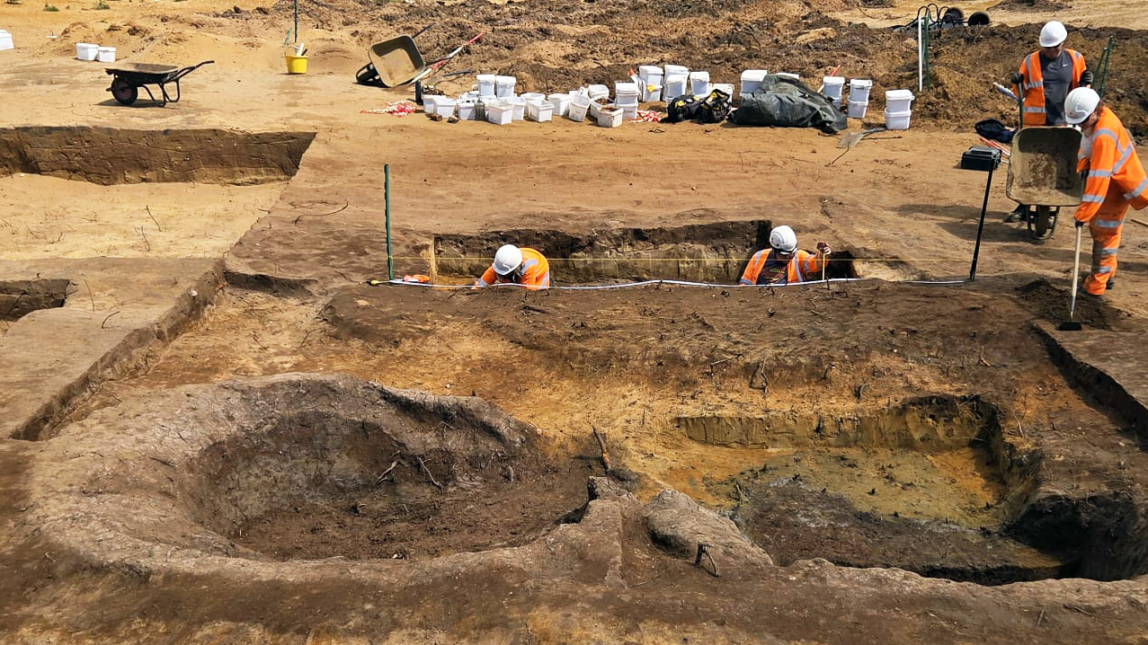
These salterns, particularly one at Goose Hill (featured in Ed Tolley’s tour of Goose Hill), are magnificent features, but more than that, much more than that, we also think we could have, at the nearby Campus site, the place where the salt workers would have lived. They would have likely been seasonal workers, perhaps even coming up from Gaul, arriving in late Spring, and leaving at the end of the summer.

The ‘Hub’ where they may have lived is small, just one hectare in size, set along a north-south road and comprised of a variety of posthole and sunken buildings, a small smithy, dozens of latrine pits, lost coinage, and a vast amount of waste material. Unsurprisingly, some of this waste is quite fancy imported pottery – there was money in salt, literally, it’s where we get the word salary.
The Hub was linked to the saltworks by a series of trackways across what would perhaps have been rough sheep pasture, and along one of these, halfway between the Hub and the salterns, is a line of small burial mounds, perhaps the resting places of those salt workers who never made it home to Gaul.
Image: a piece of Roman Samian Ware found on Campus during excavations
As we strip back new layers and open new areas we find ourselves asking more questions but also identifying sharper patterns and finding the occasional surprise that forces us to rethink exactly what it was we thought we knew. Sizewell continues to be a place where the past refuses to sit quietly, and as the work rolls on there’s every reason to believe it still has plenty more to reveal.