
Sizewell C
Two Village Bypass
Start Date
October 2024 - Ongoing
Location
Suffolk
Time Period
Bronze Age,
Medieval,
Post-medieval,
Client
EDF,
The Two Village Bypass (TVB) runs alongside villages Stratford St Andrew and Farnham, Suffolk, on a south-facing slope bordered by three valleys. To the east lies the broad valley of the River Alde, while to the south, a smaller valley carries one of its tributaries and to the west is a shallow dry valley that once held a small watercourse. The location of the TVB site not only impacted the ways in which humans used its landscape in the past, but also shaped the survival of archaeological evidence into the present.
Bronze Age barrow
One of the earliest features found at TVB was the remains of a possible Bronze Age round barrow. This barrow would have stood on high ground overlooking the three valleys, making it a prominent landmark for thousands of years.
Although the barrow’s mound had since disappeared, the circular ditch that once encompassed it was discovered during the excavation. A rectangular pit was also found near the centre of the barrow, which may have been some form of chamber situated beneath the mound. Interestingly, no human remains or evidence of burial were found within the chamber, suggesting the chamber may have been empty from the start, served as a cenotaph, or had its contents removed before the chamber’s eventual collapse.
Image: possible Bronze Age round barrow


In the 17th or 18th century someone dug a large pit down into the mound, perhaps attempting to investigate or loot its contents. It is possible that this was an attempt by an antiquarian to investigate the mound, although it may simply have been an example of looting or treasure hunting. At some point after this event, the mound was destroyed and ploughed away, and nothing is shown on late Victorian maps of the site.
Image: creative imagining of the antiquarians excavating the barrow at TVB
Medieval roadway, buildings and field systems
Crossing the northern part of the site was the remains of a roadway, which was the original route of what is now the A12 before it was diverted further north to its present location in the early 19th century. This roadway, which skirts around the edge of the valleys surrounding the site, is thought to have Roman origins. The placename Stratford St Andrew, also suggests the presence of a Roman road; Stratford means roughly “street over a forded crossing”, the word street being a common element in old placenames where Roman roads are found.
The earliest features associated with the roadway were medieval ditches flanking either side of it, alongside several buildings that lined its route. Only the compacted clay floors of these buildings survived, alongside a few postholes and the scorched remains of hearths. In a few cases, the rough outline of rooms could be discerned where gaps in the clay floors suggested the position of walls.
Image: medieval buildings which can bee seen in surviving floor surfaces


These buildings would probably have been timber-framed houses sited along the roadway, and the detritus of the inhabitants was found around them, such as pottery and iron nails. The dateable evidence suggests that they were occupied from around the 12th to 14th centuries, a time when there was an expansion of the rural population.
To the south of the road and buildings were ditches that would have formed the boundaries of large rectangular fields. Some of these medieval field boundaries persisted into the 19th century, with the ditch marking the boundary being periodically ‘recut’ to remove sediment that had filled it.
As well as fields, a large area of quarrying was uncovered within the dry valley running down the western part of the site. This quarrying would have been just behind the medieval buildings, and appears to have been targeting the sands and gravels, perhaps to collect material to form road and yard surfaces, whilst sand was a vital component in lime mortar.
Further south there was an unusual concentration of ditches, postholes, and pits within an area that would have been waterlogged much of the time. At the moment, it is not clear what this activity was or why it was so heavily concentrated in this wetter area.
Image: an engraved buckle, characteristic of the 14th century, specifically a type concentrated in southern France and southern/eastern England
Close to the activity further south of the dry valley, were several lines of tightly spaced postholes, appearing to form what would have been a fence line. In places, a narrow trench was dug first and the posts were set within it.
This unusual boundary, likely a palisade, was probably not defensive due to its small posts and lack of a ditch. Unlike typical field boundaries, which used simpler and longer-lasting ditches and banks, a timber palisade required greater resources, especially in the medieval period. Its construction suggests a need to control animal movement—possibly the pale of a medieval deer park.
The site lies just east of Little Glemham Park, which has ancient origins, and the palisade may represent an earlier boundary. Such fences were used to keep game in and poachers and wandering farm animals out.
Image: schematic illustration of palisade fence

Turnpike Road
Although the medieval buildings lining the road seem to have disappeared in the early post-medieval period, the road they flanked continued in use. It was eventually turnpiked in 1792, with the creation of the Aldeburgh to Yoxford Turnpike Trust.
In the past, local communities had to maintain roads passing through their parishes out of their own resources. This could be unfair for small communities that happened to have major roads running through them, as not only would the damage caused by the greater volume of traffic be worse but most of it would have been through-traffic on its way to elsewhere and so not directly related to the community being affected.
From the 17th century, some major roads were turnpiked – tollbooths were set up to charge traffic using that road and the revenue collected then used to repair and maintain it. Local and military traffic received passes that made them exempt from the tolls. The tollbooth had a barrier pole (the ‘turnpike’ itself) which was raised or lowered to admit traffic. Because setting up tollbooths required obstructing the public highway, each turnpiking of a road required an act of parliament to set up.

The effect of turnpiking the road running through TVB was uncovered during the excavation as a series of gravel layers that had been laid down to build up and consolidate the road surface. The gravelling of the road will have been paid for using money raised through tolls. The new road surface was found to partially overlay the backfilled remains of the earlier medieval boundary ditches that had flanked the original road.
The stones used to create the new road surface was made up of gravels dug out of quarry pits close to the site. Several of the post-medieval quarry pits found on site, which were dug into the glacial sands and gravels to obtain the necessary stones for use in road and yard surfaces, were backfilled with sand – this suggests that the stones and gravels were the main target of the quarrying, and that these had been sieved out from the rest of the material and the unwanted sand dumped back in the pits.
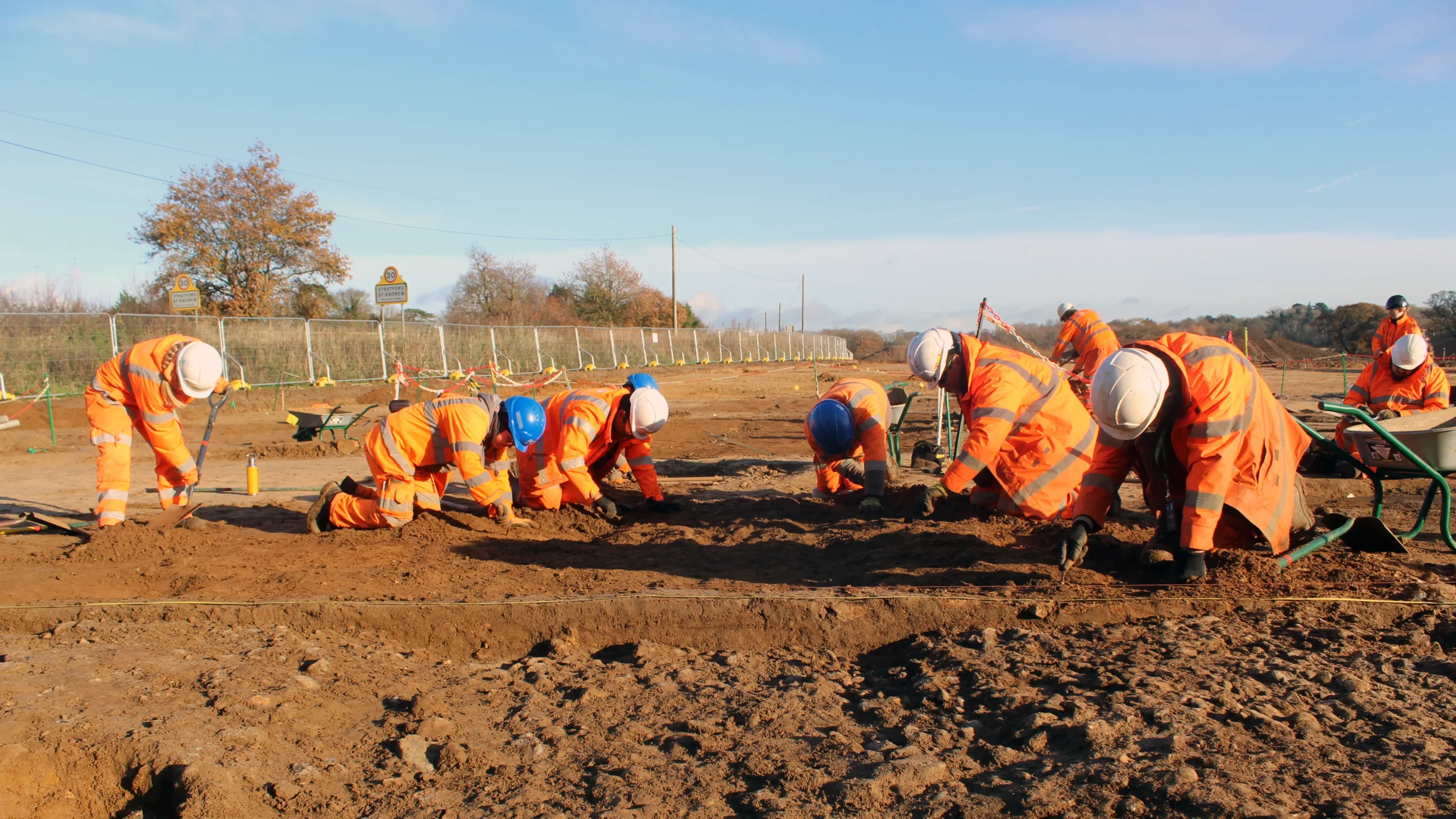
Image: the team uncovering the top of the roadway
The road was eventually diverted further north in the early 19th century with the expansion of Little Glemham Park, and the stretch that passed through the TVB was abandoned and incorporated into the nearby fields. The 19th century owners of Glemham Hall, which sits within the grounds of the park, wanted to move the road northwards so that it did not spoil their view. As most local landowners will have been members of the turnpike trusts in their area, it wouldn’t have been difficult for them to make this extraordinary change to a major road just to benefit their own desires.
After its diversion, most of the old road surface at TVB was ploughed away. However, the short stretch that ran across the dry valley in the western part of the site was better preserved, because it was deeper down and covered with later soil; this is also why the remains of the medieval buildings flanking it were better preserved in the area of the dry valley.
Image: aerial view of Glemham hall. Image courtesy Oublew
