
The moving monastery: The story of Leiston Abbey

In medieval times, Leiston Abbey owned much of the land where we are conducting archaeological work in preparation for the Sizewell C development. The story of the religious community who lived and worked at the abbey is one of two halves. On the one hand, their connection with the landscape around the abbey is one of the taming of heath and coastal marshland, but on the other it’s a story shaped by the wildness of the sea.
The first abbey site
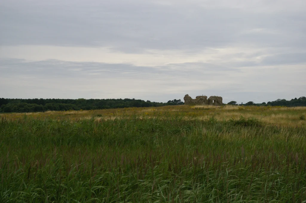
Leiston Abbey was founded in 1182 and originally stood on an island within the saltmarsh and coastal waters of the Minsmere Haven, where the Minsmere Levels are now. The original location was accessed along a causeway. The foundations of the church, cloister, buildings, fish pond, water channels and enclosures are all visible as cropmarks.
Image: the ruins of the first abbey site. Photograph – Christopher Hilton submitted to Historic England Missing Pieces Project
The community at the abbey
The abbey was home to around twenty Premonstratensian Canons. Their name comes from their parent house at Prémontré in northern France. They were also known as White Canons because of their habits, or Norbertines, after their founder Norbert of Xantan. There were only thirty-five Premonstratensian houses in England and no others in Suffolk.
Their order was modelled on that of the Cistercians, which emphasised isolation, austerity and manual labour, in response to the excesses of some wealthier monastic houses. The locations of their abbeys were often isolated or in difficult to reach areas like marshland.
The canons lived according to the rule of St Augustine, a guide for communal religious life. However, like friars, their work involved ministry, and in the late 13th century they served as rectors at the parish churches of Leiston, Aldringham, Middleton and Culpho. They would have been familiar figures to local people.
The abbey’s estate
The abbey was founded by Ranulph de Glanville, an important local magnate, and he granted the manor of Leiston to the abbey’s community which provided most of their income. The manor was one of the largest in Suffolk, extending to neighbouring parishes. It was also one of the most consolidated estates in the county, meaning its lands were all located closely together. The pattern of landholding differed from some of the older monastic houses, which had large and often scattered estates, but it was not so unusual for a foundation of its date and type.

The abbey had a right to various dues such as the markets at Leiston and Sizewell, where it plied its fishing trade. The settlement of Sizewell was larger in medieval times, but has been largely lost to coastal erosion. The abbey also had income from its churches, and the rights to half of the value of wreckage washed up on the beach, but it depended particularly on its lands supplying the abbey directly and for goods to sell.

Cistercian and Premonstratensian abbeys, sited in isolated locations, often acquired tracts of marshland, woodland and uplands which had not been intensively settled. They developed a model of land management based upon granges, which were farms that lay at the centre of blocks of land, worked by monks, lay brothers or hired help and their outputs were often specialised to the environments in which they were located. Some, for example, focused on sheep and cattle.
The character of the landscape within the manor of Leiston, mostly poor sandy heathland and marsh, meant that effort had to be put in to make it productive. However, the community were undoubtedly chosen by the founder for expertise which matched the landscape.
Image: marshland at Minsmere. Photograph – Airwolfhound
The marshes provided sedge and peat for fuel, but reclamation of them also provided valuable arable and pasture land and in the 12th and 13th centuries, like other monastic institutions, the community must have been actively working to drain land. One or two stretches of sea bank locally appear to be of medieval date.
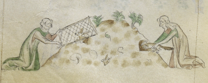
The sandy soils, although later dominated by sheepwalks (a local term for sheep pasture), were in the centuries around Domesday (1086) originally a mixed landscape of woodland and heath. These provided valuable income from whins (gorse, broom, heather or furze cut for fuel), but was also valuable grazing land. These soils could also be farmed, if improved by the application of dung and waste. To the south of Leiston Manor, a large area of such land was used for the Abbot’s warren, a source of hares, partridges, rabbits and pheasants.
Systems of grazing were important to maximising the resources of the manor. Winter pasturing was undertaken on arable land and heath, including the warren, so that the dung from animals could improve the soil. Droveways and routes such as Sandy Lane were used to move animals to summer pasture on the marshes and commons to the north.
The second abbey site
The agricultural systems worked until climate conditions in the 14th century caused increased storm surges and serious flooding of lower lying land. In 1344–5, the abbey obtained a licence to acquire further lands, as the frequent flooding from the sea over their lands had impoverished them. The inundations also affected the foundations of the abbey buildings.
In 1365, the abbey community moved to new and larger buildings on higher land closer to Leiston. The extensive ruins and earthworks, are one of English Heritage’s free entry sites. The fabric includes reused material from the old abbey, which was largely demolished, but was retained as a cell or retreat, with a chapel left on the site. The new abbey was damaged by fire in the 1380s, and after the rebuild, and perhaps reflecting the state of the country in the years after the Black Death, it was burdened with debt.
Image: the ruins on Leiston Abbey’s second site

Image: reconstruction painting showing an aerial view of Leiston Abbey as it may have appeared in the early 16th century. © Historic England Archive
Questions for archaeology
The abbey was a major influence to life and landscape in the area, and the archaeology has significant potential for us to find out more. There is much that is not documented, such as information on the running of the abbey’s medieval farms.
What sort of activity was undertaken at the abbey’s farms, and at what date? Will we be able to see the major historical changes and environmental changes in archaeological evidence for daily life and the working of the land? There is even a possible Deer Park in the manor for which the site is not truly known.
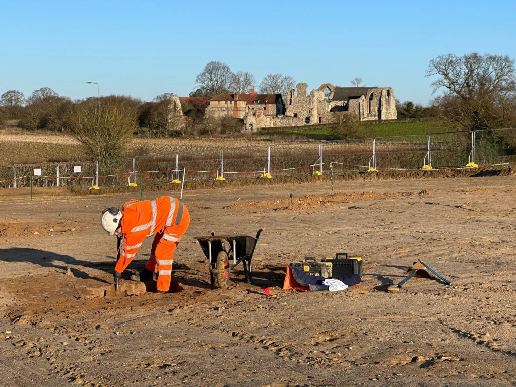
Image: OCA archaeologists working on the Sizewell C excavations near the ruins of the abbey’s second site
Alongside excavation works, further documentary research will build on the work of the late Tony Breen, a historian whose work in the Sizewell area provides much of the basis of current knowledge.